


Monday 11 September 2023
| Distance (km) | 12 kms | |||
| Distance (time) | 5 hrs | |||
| Climb / Descent | 90m / 1460m | |||
| Hard / Soft surface | 20% / 80% | |||
| Landscape |
|
|||
| Weather |
|
|||
|
|
||||
|
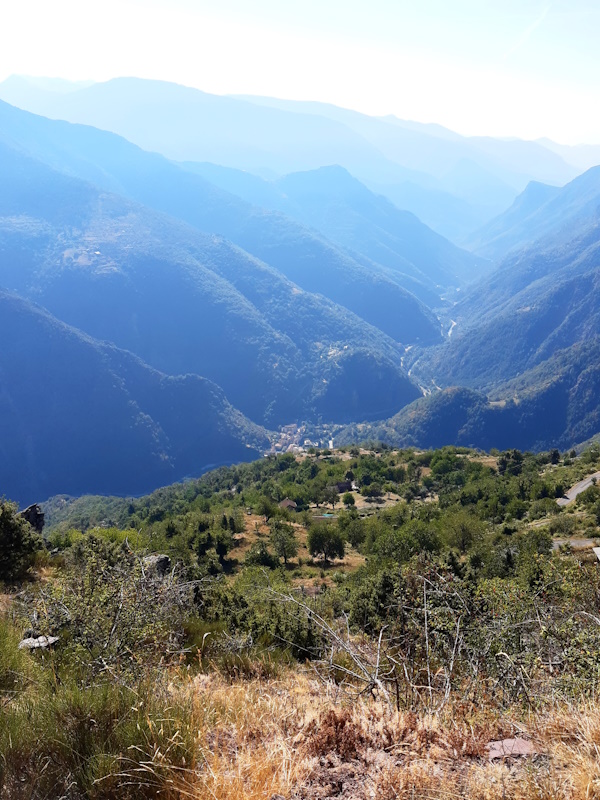
Descending is not our thing, at all. So what about a stage that is a 5 hours descent from 1900m altitude down to 500m?
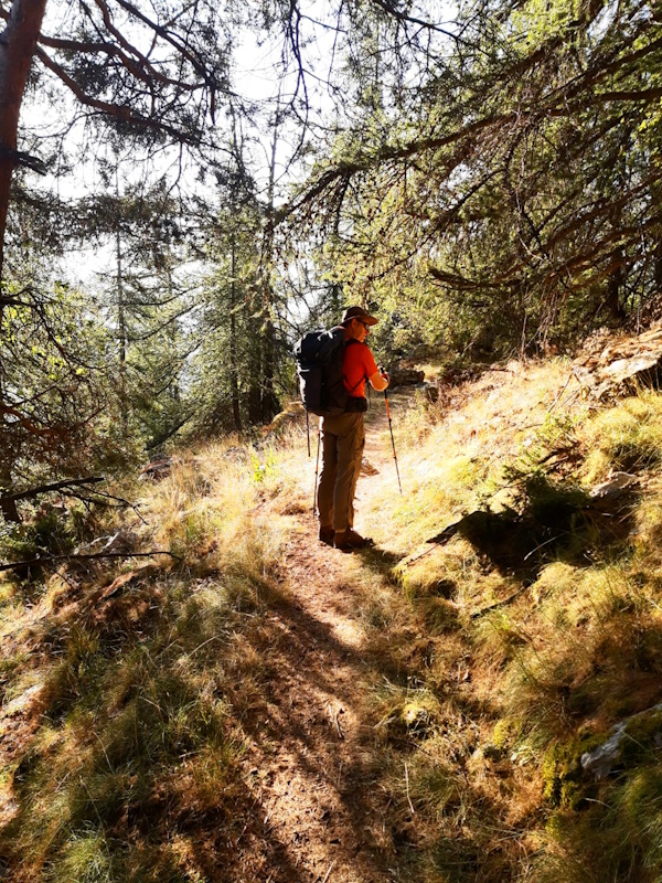
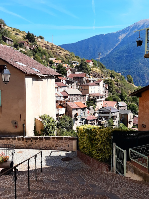
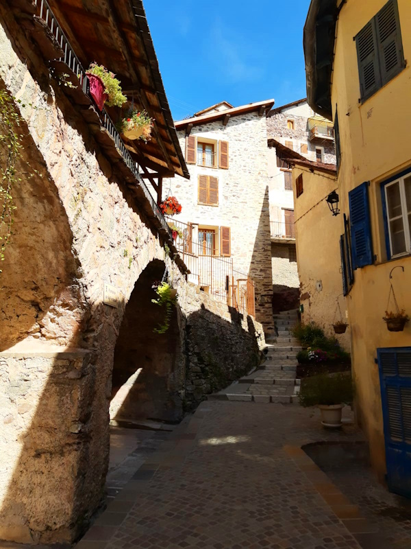
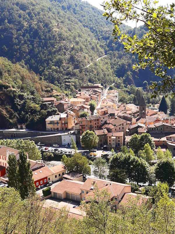
Let's put it mildly... we're not looking forward to it. We have breakfast again at 7am and start walking just after 8am. The first few hundred meter are easy, it's just the continuation of yesterday: gently down the stream. But the joy doesn't last long when the stream literally falls over the far edge of this little valley, and so does the trail. We're staring into a 1.4km deep hole and we have to get to the bottom of it. So the path starts steeply zigzagging down, but was made in such a way that it almost feels like going down stairs. Apart from the fact that it scary staring down that hole all the time as we both have vertigo. Now you may wonder then why we walk in the mountains, but that's a long story. Or actually it is not so long: we regularly wonder that ourselves too. We survive the steep part and enter the forest where the gradients become more pleasant. But the path remains a narrow little ribbon glued against the mountain side. At some point we even start climbing a bit again before ending up on a small plateau with some spread out houses: the hamlet Rougios. From here we follow a gently descending forest roast for quite a while until at a small parking called "La Barre" where the forest road becomes a tarmac road. To avoid walking on the tarmac the GR5 turns into a path again shortcutting the hairpins of the tarmac road. Usually in those cases the path is very steep and stoney so that we would almost prefer to follow the tarmac, but here it is better and I would almost say it is quite doable. Close to the village Roure we run into an elderly couple that stayed overnight in both Roya and Longon like us and they cleary just finished lunch. We have a short talk and let them go first. They're clearly better in descending than us considering we left at almost the same time and they're already here after lunch while we still have to have lunch. We arrive in the village Roure, also glued against the mountain side. Here we have a lunch stop and stretch our legs a bit because according to other walkers the worst part is now to come and we'd rather do that well rested. So after some bread and sausage and a short talk to a curious local we continue our way. First down through the village and then along the edge over a little concrete path/road that feels like almost hanging over the abyss. It's a bit spooky to be honest. We now leave Roure over a gently descending path. And actually we keep doing that for a long time, so why is this part considered the worst part? It more looks like some ancient road since the path is very wide and the slope is very regular. The only thing we can think of is that the path is on a south facing slope with almost no shadow, so in high summer it's probably very warm here. Not far before St.Sauveur we leave this nice road and ok, the last bit is quite steep. But nothing dangerous or so. And so we walk into St.Sauveur when the church bell rings 1 o'clock. Not bad. So all our worries were unnecessary. But we still don't like descending. |
      |
|||
|
|
||||
Download track LonStS.gpx